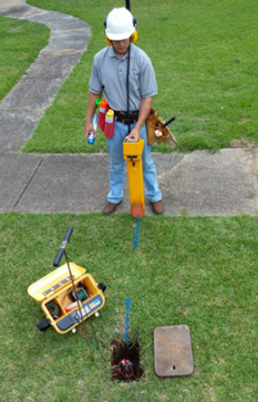
Subsurface Utility Engineering
 Are you planning a feasibility study to determine if a project is practical?
Are you in the design phase of a project?
Consider our non-invasive subsurface search, detection, and mapping services.
Our Geophysical Surveys are performed in accordance with the ASCE 38-02 quality levels as outlined in the “Standard Guideline for the Collection and Depiction of Existing Subsurface Utility Data”.
We perform pre-project deployment research of available records pending specific project objectives, this information integrated with our field results for comprehensive depiction of the subsurface environment. We provide comprehensive and accurate documentation of site-specific civil features and interpreted subsurface detected features based upon geophysical technology responses and land survey of field markings, all in accordance with ASCE 38-02 guidelines.
We provide detailed and descriptive scaled plats.
-preview.jpeg)