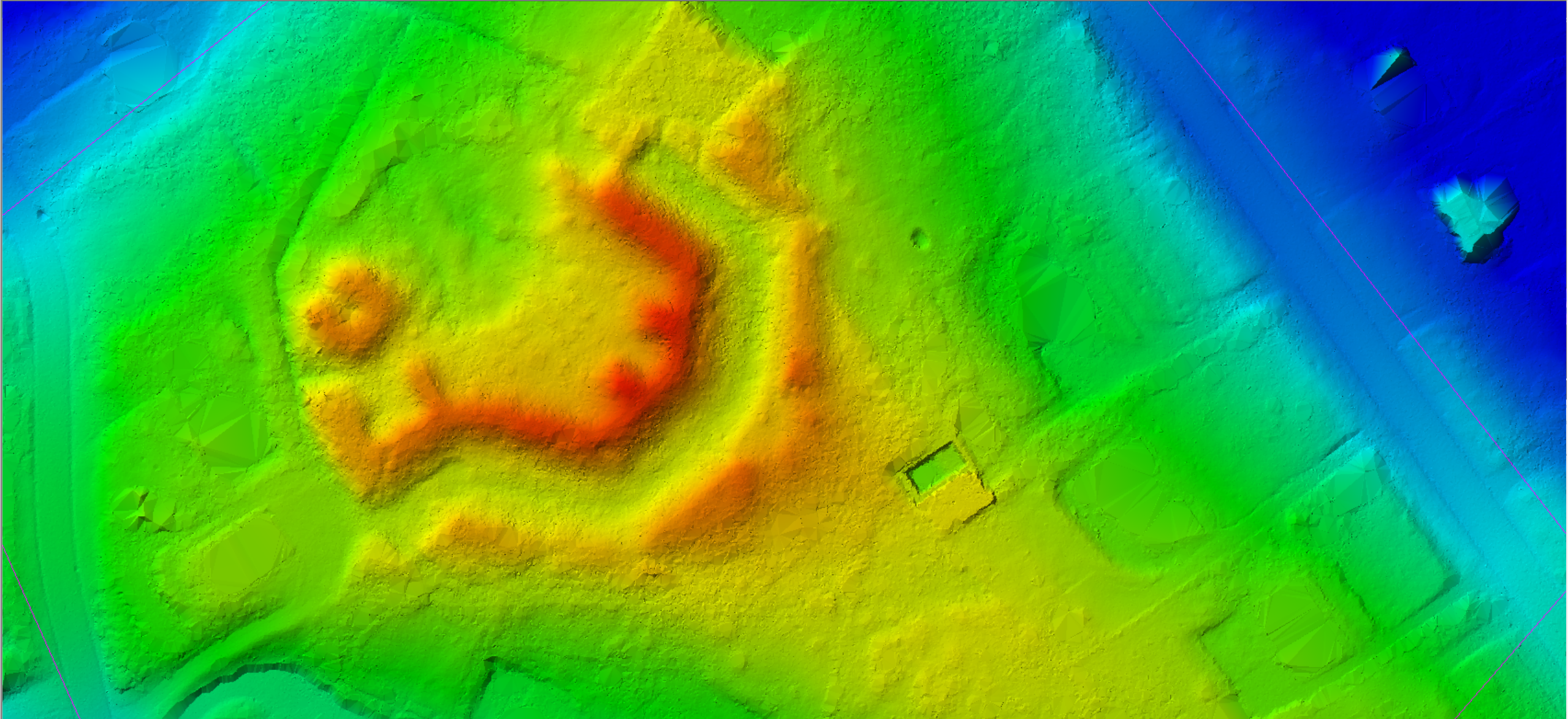
Detailed civil feature mapping utilizing the latest remote sensing LiDAR technology. This cutting-edge approach provides highly accurate surface data by capturing millions of elevation points, allowing for precise visualization of terrain, structures, and natural features. LiDAR is especially effective in areas with dense vegetation or complex topography, enabling engineers and planners to see what traditional surveys might miss.
Our LiDAR-based mapping solutions support a wide range of applications, including site planning, utility layout, floodplain analysis, roadway design, and environmental impact assessments. By integrating LiDAR with other geospatial data, we deliver comprehensive, reliable maps that meet the accuracy and compliance requirements of public and private sector projects.
High resolution inspection of inaccessible or challenging areas to ensure safety
Unmanned Aerial Vehicles (UAVs) offer a safe and efficient solution for inspecting hard-to-reach or hazardous environments. Using high-resolution imaging and real-time video capabilities, UAVs can capture critical visual data on infrastructure such as communication towers, power lines, rooftops, and other elevated or confined spaces—without putting personnel at risk. These aerial inspections minimize downtime and improve accuracy by providing clear, detailed imagery from virtually any angle.
E. F. Thompson Geotechnologies, Inc. deploys UAV technology to enhance safety assessments, detect structural concerns, and support preventative maintenance planning. Our certified pilots operate UAVs equipped with advanced optics to identify faults, corrosion, and other potential issues long before they become costly problems. By leveraging drone-based inspections, we reduce the need for scaffolding, lifts, or rope access—keeping your team safer while ensuring the highest standard of data collection.
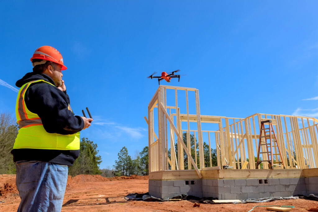
Our UAV services have been effectively utilized for construction monitoring and routine progress reporting
Our UAV services have proven to be a valuable asset for construction monitoring and progress documentation across a wide range of project types. By capturing high-resolution aerial imagery and video at scheduled intervals, we provide project managers, engineers, and stakeholders with a clear and up-to-date view of site development from start to finish. This visual record improves coordination, enhances transparency, and supports decision-making with real-time context.
E. F. Thompson Geotechnologies, Inc. utilizes drone-based monitoring to track material staging, structural changes, site access, and overall progress with unmatched efficiency. These UAV flights can be conducted regularly without disrupting operations, delivering detailed reports that can be easily shared across teams or integrated into project management workflows. Whether for internal oversight or client reporting, our UAV solutions streamline construction documentation while improving project visibility and accountability.